
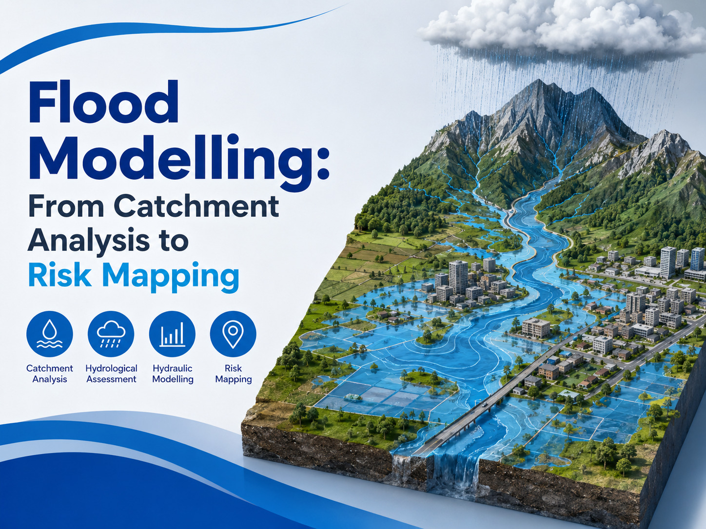
Flooding is one of the major natural hazards that can affect residential areas, industrial developments, agricultural land, roads, drainage networks, and critical infrastructure. Rapid urbanisation, changing rainfall patterns, inadequate drainage capacity, and development in flood-prone areas can increase the potential impact of flood events.
For this reason, understanding how water behaves during heavy rainfall and extreme flow conditions is important for safer planning and infrastructure development. Flood Modelling provides a scientific approach to analysing water movement, identifying vulnerable locations, and supporting effective flood risk management.
What Is Flood Modelling?
Flood Modelling is a technical process used to simulate how rainfall, runoff, and water flow behave across a defined geographical area. It combines information such as rainfall data, topography, drainage characteristics, river or stream conditions, land use, soil properties, and catchment behaviour to understand potential flooding scenarios.
The objective is not simply to determine whether an area can flood. A detailed model can help understand the likely extent, depth, direction, and behaviour of floodwater under different conditions. This information can then be used by planners, engineers, developers, and authorities when evaluating projects and designing suitable mitigation measures.
Bhoojal Survey supports flood-related studies by using technical assessment and spatial analysis to develop a clearer understanding of hydrological and hydraulic conditions affecting a project or study area.
Importance of Catchment Analysis
A catchment is an area from which rainfall and surface runoff drain toward a common outlet, such as a river, stream, lake, or drainage system. Understanding the catchment is an important part of any flood study because water generated upstream can influence downstream areas.
Catchment Analysis examines characteristics such as catchment boundaries, drainage patterns, slope, elevation, land use, soil conditions, stream networks, and runoff behaviour. It helps determine how quickly rainfall may be converted into surface runoff and where that water is likely to travel.
A proper catchment assessment can also help identify areas where runoff may accumulate, drainage channels that may become overloaded, and locations where water could move toward developed areas. This information provides an important foundation for subsequent hydrological and hydraulic analysis.
Role of Hydrological Assessment
A hydrological assessment focuses on the relationship between rainfall and runoff within a catchment. Historical rainfall records, rainfall intensity, duration, frequency, catchment characteristics, and runoff parameters may be considered to estimate the amount of water generated during different rainfall events. Different return-period rainfall events can be evaluated to understand how a catchment may respond to moderate, severe, or extreme conditions.
The resulting flow estimates can provide essential inputs for hydraulic analysis. Hydrological assessment is particularly important where a proposed development could alter existing drainage patterns. Roads, buildings, paved surfaces, and other changes in land cover can affect infiltration and increase surface runoff. Understanding these changes helps support more informed flood planning.
Hydraulic Modelling and Water Flow Analysis
While hydrological analysis helps estimate runoff and flow, Hydraulic Modelling focuses on how that water moves through rivers, streams, drainage channels, floodplains, and other flow paths.
Hydraulic models can consider channel geometry, terrain elevation, roughness characteristics, structures, flow conditions, and other relevant parameters. The model can simulate water levels and flow behaviour under selected scenarios.
The results may help identify locations where water levels could rise significantly or where existing channels and drainage infrastructure may have limited capacity. Hydraulic analysis can therefore provide useful information for drainage planning, flood mitigation, infrastructure design, and development decisions.
Flood Inundation Mapping
One of the most useful outputs of a flood study is Flood Inundation Mapping. These maps visually represent areas that could potentially be affected by floodwater under specific rainfall or flow scenarios.
Depending on the study requirements, flood maps can indicate the approximate extent and depth of inundation. They can also help show how flood conditions may change between different scenarios. Flood inundation maps are valuable for communicating technical results to decision-makers because complex modelling outputs can be converted into clear spatial information.
They can support identification of vulnerable buildings, roads, agricultural areas, public facilities, and other assets. Bhoojal Survey can assist in interpreting flood-related spatial information and presenting technical findings in a way that supports practical planning and risk evaluation.
Flood Risk Assessment for Better Planning
A flood risk assessment evaluates the potential consequences of flooding by considering both the likelihood of flood events and the assets or communities that may be exposed to them. It can help identify areas where additional investigation, protection, or mitigation may be necessary.
Risk assessment may consider flood depth, flow velocity, inundation extent, existing infrastructure, land use, population exposure, and the sensitivity of important assets. The results can support decisions regarding site selection, development planning, drainage improvements, flood protection measures, and emergency preparedness.
For developers and organisations planning projects in areas with potential flood hazards, early assessment can be particularly valuable. Identifying risks before construction can help avoid costly design changes and reduce potential disruption later.
Applications of Flood Modelling Services
Professional Flood Modelling Services can be useful across a wide range of projects. They may support urban development planning, industrial projects, transportation infrastructure, drainage studies, river and watershed management, environmental assessments, and flood mitigation planning.
Flood studies can also help evaluate existing drainage conditions and identify locations where improvements may be required. Where development changes natural runoff patterns, modelling can help assess the potential downstream implications and support suitable drainage or stormwater management strategies.
The value of modelling depends heavily on the quality of input data, the suitability of the selected methodology, and proper interpretation of results. Therefore, flood analysis should be carried out systematically and with attention to the specific characteristics of the study area.
Why Professional Flood Assessment Matters
Flooding is influenced by several interconnected factors, and relying only on historical observations may not provide a complete picture of future flood behaviour. A technical modelling approach allows different scenarios to be examined before they occur.
Bhoojal Survey combines hydrological understanding, catchment assessment, hydraulic analysis, and spatial interpretation to support informed flood-related decisions.
By understanding where water originates, how it moves, and which areas may be exposed, project stakeholders can develop more practical strategies for reducing flood-related impacts. Effective flood planning is ultimately about making decisions based on reliable information.
From catchment analysis and hydrological assessment to hydraulic modelling and inundation mapping, each stage contributes to a clearer understanding of flood behaviour. When these components are evaluated together, they can provide valuable insights for safer infrastructure, responsible development, and long-term flood risk management.
Frequently Asked Questions
1. What is Flood Modelling used for?
Flood Modelling is used to understand how water may move across a catchment during rainfall or high-flow events. It can help estimate flood extent, water depth, flow behaviour, and potentially affected areas.
2. Why is Catchment Analysis important in flood studies?
Catchment Analysis helps determine how rainfall becomes runoff and how water travels toward rivers, streams, drainage systems, or other outlets. It provides important information for understanding the source and movement of floodwater.
3. How does Hydraulic Modelling differ from hydrological analysis?
Hydrological analysis generally focuses on rainfall, runoff, and flow generation, whereas Hydraulic Modelling examines how the resulting water moves through channels, floodplains, drainage networks, and other areas.
4. What does Flood Inundation Mapping show?
Flood Inundation Mapping shows areas that may be covered by floodwater under selected scenarios. Depending on the study, it can also provide information about flood depth and the spatial extent of inundation.
5. Can flood studies support infrastructure planning?
Yes. Flood studies can provide valuable information for site planning, drainage design, infrastructure development, flood mitigation, and identifying areas that may require additional protection or assessment.
Comments
Log in or sign up to join the conversation.